Recreational cycling: Markleeville, Ebbetts Pass, Monitor Pass
May 21-23 2005

photos by Steven Hill, steephill.tv
photo sharing conditions

Markleeville 3 day weekend

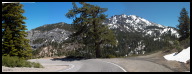
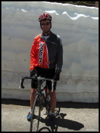
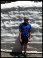
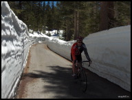
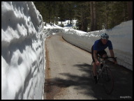
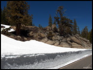
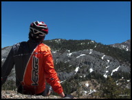
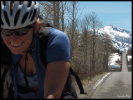
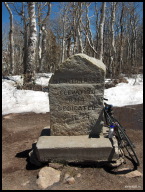
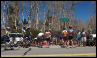
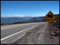
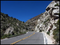
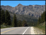
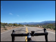
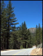
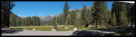
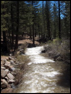
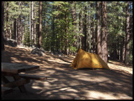
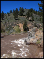
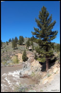
This was my fifth biking trip to Markleeville in the California Sierra-Nevada over the last three years and the best weather-wise. The conditions were perfect for cycling (mid-70s) under clear blue skies during the day and ideal for camping at night (high-40s). Unfortunately, my wife could not join me for this last minute trip and I could have spent some time in the dog house upon returning but she's understanding. The routes I rode are part of the infamous Death Ride held each July in hot, dry, high elevation conditions, which features 2600 riders attempting 129 mi and 15000+ feet of climbing. On Saturday, I rode up to Ebbetts Pass and Monitor Pass for 64 mi and 8000' of elevation gain. CA#4 was closed to cars beyond the halfway point up to Ebbetts Pass since it was not yet completely clear due to the large winter snowfall. It was fine for cyclists and we had an exclusive on Ebbetts during this perfect weekend! On Sunday, I rode a double Monitor Pass out to US395 and back for 62 mi and 7500' of elevation gain. On Monday, I rode north looping around Diamond Valley Rd and Emigrants Trail for an easy 35 miles. I started all rides from Grover Hot Springs State Park campground, the finest state park campground that I know of in California and listed in Best in Tent Camping Northern California. Also, consider one of the few motels in Markleeville - J. Marklee Toll Station Motel.
-- Steve Hill, May 25/05

view/post comments (16)


Bright, clear and warm all three days.jpg
Bright, clear and warm all three days
CA89 weaving along the swollen East Fork Carson River near Markleeville.jpg
CA89 weaving along the swollen East Fork of the Carson River near Markleeville
East Fork Carson River before CA4/CA89 (Ebbetts/Monitor) junction.jpg
East Fork of the Carson River before CA4/CA89 (Ebbetts/Monitor) junction
Vertical panorama of the East Fork Carson River.jpg
Vertical panorama of the East Fork
The (un)welcoming sign for CA4 leading up to and over Ebbetts Pass.jpg
The (un)welcoming sign for CA4 leading up to and over Ebbetts Pass
Looking down one of the nasty, steep switchbacks.jpg
Looking down one of the nasty, steep switchbacks
Snowbanks started about halfway up.jpg
Snowbanks started about halfway up. In fact, CA4 was CLOSED beyond this point to cars.
Standing in front of a sheer snowbank.jpg
Standing in front of a sheer snowbank
Gardnerville guy standing next to an 8 foot sheer snowbank.jpg
Gardnerville guy standing next to an 8 foot sheer snowbank
At the top, a mostly buried Ebbetts Pass sign belies the warm temperature.jpg
At the top, a mostly buried Ebbetts Pass sign belies the warm temperature
Descending through high snowbanks.jpg
Descending through high snowbanks
Gardnerville guy's turn to descend.jpg
Gardnerville guy's turn to descend
Typical colors - Snow white, earth tone and azure.jpg
The weekend colors - Snow white, earth tone and azure
Admiring Silver Peak (el. 10,774 ft) on the way back down.jpg
Admiring Silver Peak (el. 10,774 ft) on the way back down
Peaks and cleavages - A fellow Berkeley resident reaches the top of Monitor Pass while out training for the Death Ride.jpg
Peaks and cleavages - A fellow Berkeley resident reaches the top of Monitor Pass while out training for the Death Ride
Monitor Pass cyclist tombstone.jpg
Monitor Pass cyclist tombstone
Alta Alpina club ride regrouping at the top of Monitor Pass.jpg
Alta Alpina club ride regrouping at the top
The first glimpse of the picturesque decent into Nevada from Monitor Pass.jpg
First glimpse of the picturesque descent into Nevada from Monitor Pass
A panoramic view of Nevada (the highest peak is Mt. Grant el. 11245 ft).jpg
A panoramic view of Nevada (the highest peak is Mt. Grant el. 11245 ft)
Monitor Pass eastside switchbacks and the valley below.jpg
Monitor Pass east side switchbacks and the valley below
The east side of Monitor Pass is desert-like near the bottom.jpg
The east side of Monitor Pass is desert-like near the bottom
Turning around at the bottom to start a double of Monitor Pass.jpg
Turning around at the bottom to start a double of Monitor Pass
A small ridge marks the halfway point on the 7 mi ride heading north from Markleeville to Woodfords.jpg
A small ridge marks the halfway point on the 7 mi ride heading north from Markleeville to Woodfords
Emigrants Trail looking towards Nevada.jpg
Emigrants Trail looking towards Nevada
Hot Springs Rd while cycling back up to the campground.jpg
Hot Springs Rd while cycling back up to the campground
Still standing.jpg
Still standing
Westerly panoramic view from the campground.jpg
Westerly panoramic view from the campground
Hot Springs Creek runs through the campground.jpg
Hot Springs Creek runs through the campground
Campsite No. 27 at Grover Hot Springs SP.jpg
Campsite No. 27 at Grover Hot Springs SP
Squirrel-cam - The campground was dead quiet when I got back from my final ride on Monday.jpg
Squirrel-cam - The campground was dead quiet when I got back from my final ride on Monday


Our Photo Sharing Policy:
We have a very simple procedure for sharing these photos -- Individual photos may be posted on team and not-for-profit web sites provided they are unaltered and are appropriately credited using the following line of html directly underneath:
photo: <a href="http://www.steephill.tv">steephill.tv</a>
Once posted please notify us with a link to the photo(s).