Is this the best road bike ride in North America?

Crater Lake National Park, Oregon: Cycling the Rim - June 24 2005

Crater Lake Panorama

photos by Steven Hill, steephill.tv

Each year since 2013, the park has set aside one or two days a year for bicycles only on the East Rim:
Vehicle-Free Days on East Rim Drivenps.gov

Crater Lake Park Map

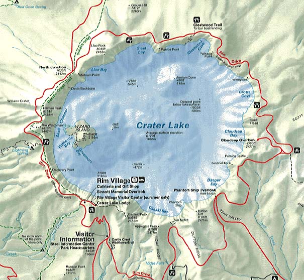
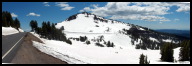
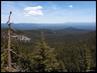
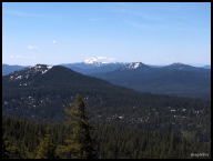
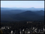
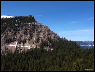
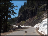
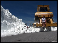
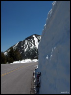
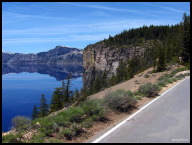
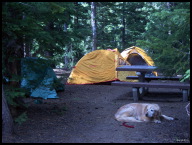
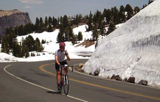
At the end of a two-week trip through the U.S. Northwest with my wife and dog (more pictures forthcoming), I cycled the 33 mile Rim Drive loop in Crater Lake National Park. What a stunning ride on a warm, sunny day. If anyone, who has done this ride, knows of a better road bike ride in North America then I'd like to see some evidence! It's challenging, incredibly scenic and fun the entire ride (no dead spots) with 3800'+ of climbing and never descends below the 6500' elevation mark. Add an additional 10 miles and 800' of climbing if you start from the Mazama campground like I did. When clear of snow, there are several optional out & backs that can add at least 15 miles. Here's bicycling information and weather data the National Park Service provides for planning a bike ride around the lake. If you'd rather stay at a luxury resort than sleep on the ground then get your Ben Franklins ready and check out the Crater Lake Lodge.

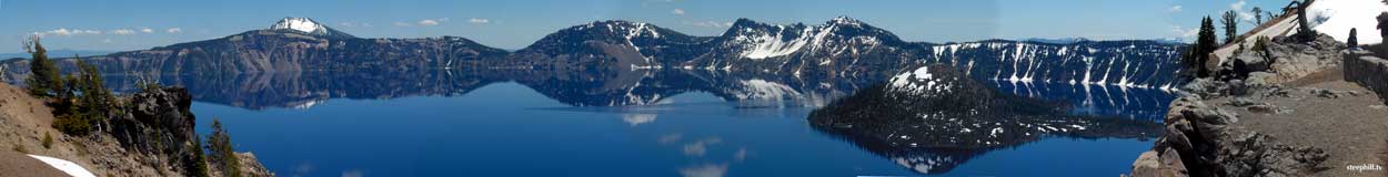
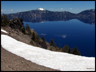
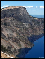
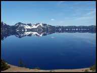
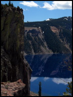
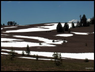
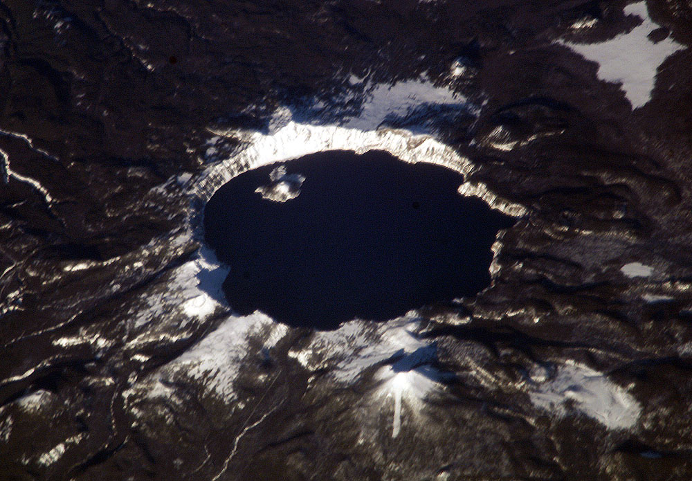
The skinny on Crater Lake is this. It was formed when a 12,000' volcano erupted and collapsed into itself 7,700 years ago with explosion about forty times as powerful as Mount St. Helens in 1980. It then filled with rain and melted snow to a maximum depth of 1,943 feet -- deeper than any lake in the United States and apparently one of the cleanest because no streams (pollution) flow into it. The depth and clarity of the water and it's ability to absorb all colors except blue and violet produce the unique brilliant jewel blue color. It snows so much that the full loop is only open for 3 or 4 months during a typical year and this past month, the park had to re-close the east rim road after a late snowfall.

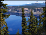
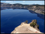
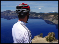
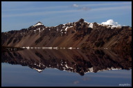
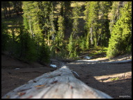
This photo tour moves counter-clockwise along Rim Drive starting from the west rim although clockwise is the preferred direction when a partial road closure is not a potential problem. An even better idea is to cycle the rim in both directions! So, put on your favorite cycling music and enjoy the ride. -- Steve Hill June 28/05

view comments (14)

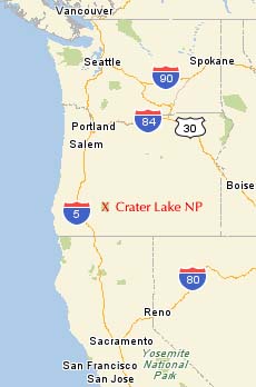
Crater Lake Organized Bike Rides

Crater Lake Century

Crater Lake Locator Map Marilyn Photo Friday July 8, 2005 update:

Hi Steven,
Remember me taking this picture at Crater Lake?  Just got home from vacation...I live in Illinois (a little different elevation from Oregon.)  Anyway hope this works.....checked out your website.....cool!

Ride On!
Marilyn Minneman
Champaign, IL

Thanks Marilyn!
Jaws drop when Crater Lake is viewed for the first time. Mt Scott, behind Cloudcap Outlook, is the highest point in the park at 8929'.jpg
Jaws drop when Crater Lake is viewed for the first time. Mt Scott, behind Cloudcap Outlook, is the highest point in the park at 8929'
Cloud reflections.jpg
Cloud reflections
Looking south on the west Rim Drive as the road sneaks past The Watchman (el. 8013').jpg
Looking south on the west rim as the road sneaks past The Watchman (el. 8013')
The Watchman (or Hillman Peak?) viewed from Discovery Point.jpg
Hillman Peak from Discovery Point... killer view or what?
The view in the other direction wasn't too bad either.jpg
The view in the other direction wasn't too bad either
National Forests and Mt. McLoughlin (el. 9495') mark the southern end of the Cascades Range.jpg
National Forests and Mt. McLoughlin (el. 9495') mark the southern end of the Cascades Range
This southeast vista from Rim Drive reminded me a little of the Blue Ridge Mtns in North Carolina.jpg
This southeast vista from Rim Drive reminded me a little of the Blue Ridge Mtns in North Carolina
The east side of the Rim Drive was closed to vehicles. Another exclusive!.jpg
The east side of the Rim Drive was closed to vehicles. Another exclusive!
A little snow and debris wasn't enough to prevent me from making a loop of the Rim.jpg
A little snow and debris wasn't enough to prevent me from making a loop of the Rim
However, it was unclear how I was going to get out to Cloudcap Outlook - an optional part of the ride. Would Jobst have slogged on?.jpg
However, it was unclear how I was going to get out to Cloudcap Outlook - an optional part of the ride. Would Jobst have slogged on?
A big snowbank or the edge of a glacier?.jpg
A big snowbank or the edge of a glacier?
Jewel blue makes azure seem pale.jpg
Jewel blue makes azure seem pale
Peering at the north end of the rim with 8-9000' Cascades Range peaks in the distance.jpg
Peering at the north end of the rim with 8-9000' Cascades Range peaks in the distance
West rim reflections viewed from Palisade Point, north rim.jpg
West rim reflections viewed from Palisade Point, north rim
Reflecting on reflections.jpg
Reflecting on reflections
Pumice Point, north rim.jpg
Pumice Point, north rim
Unobstructed views make for a great ride... but, like all parks, be aware of Winnebago Wally who's coming up from behind and admiring the same view.jpg
Unobstructed views make for a great ride... but, like all parks, be aware of Winnebago Wally coming from behind and admiring the same view
Mirror images.jpg
Mirror images
Snow white brush strokes.jpg
Snow white brush strokes
He won't pitch his own tent, but he can snooze with the best of them.jpg
He won't pitch his own tent, but he can snooze with the best of them
Be careful finding a tree at night when your campsite backs onto this ravine.jpg
Be careful finding a tree at night when your campsite backs onto this ravine
Aerial photo of Crater Lake (source: nasa.gov)