(The free QuickTime player may be needed to view the movies)
29 photos & movies (![]() ) by Steven Hill & Rebecca Heald, steephill.tv
) by Steven Hill & Rebecca Heald, steephill.tv
(The free QuickTime player may be needed to view the movies)
This is the third episode from our June 2005 Northwest State and National Parks trip. The other posted episodes are Humboldt Redwoods State Park: Cycling and hiking among the Giants and Crater Lake National Park: Is this the best road bike ride in North America?
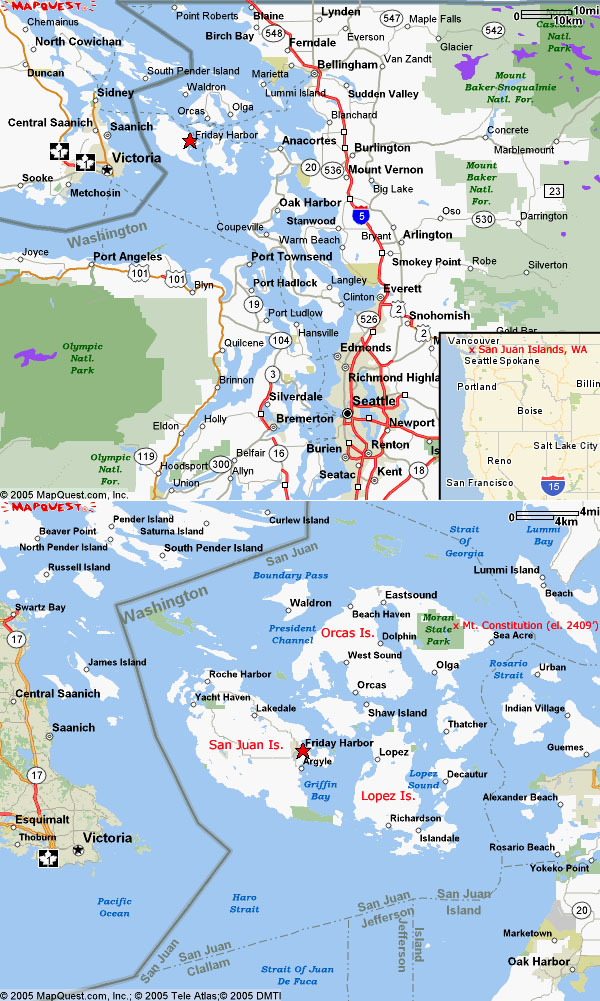
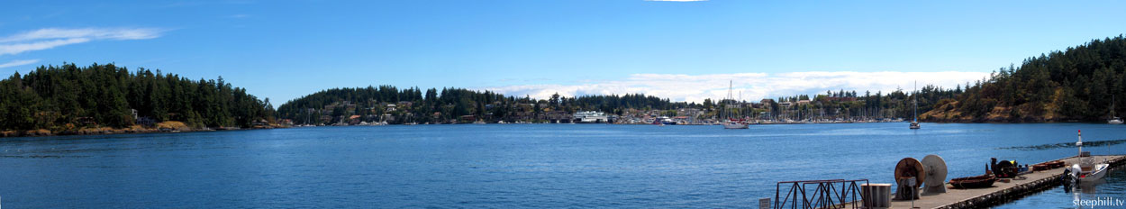
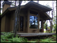
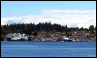
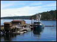
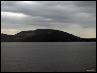
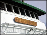
The furthest destination on our two week trip was the archipelago off the northwest corner of the continental United States called the San Juan Islands. Rebecca was invited to give a "talk" at Friday Harbor Labs, a marine biology research facility affiliated with the University of Washington, in addition to her seminar at the main campus in Seattle. We stayed in one of their serene Whitely Center visitor cabins for four relaxing nights. Friday Harbor is located on the largest island called San Juan Island and to clarify, the archipelago is called the San Juan Islands and the largest island in the archipelago is called San Juan Island. The Islands are protected by the mountains on the Olympic Peninsula, giving them 250 days of sunshine a year and half the rain that Seattle gets some 60 miles away. In addition to the temperate year-round weather, the scenery and seclusion make this a popular destination for vacationing and year-round retirees. For now, it's still a relatively unknown place, but escalating real estate prices are an indication things are changing.
| Do you know the distinction between a sound, strait and channel? | The term for connecting two large bodies of water can be a sound, channel, or strait. Do you know the broad difference? By definition, a sound is a wide channel and a channel is a wide strait; however, the Straits around the San Juans Islands, are much larger than the Sounds and Channels. Is it too late to get it straight? |
|---|
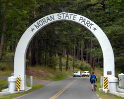
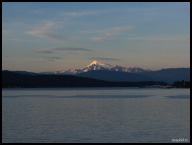
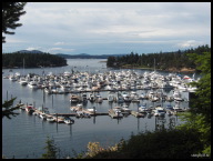
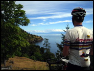
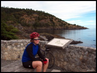
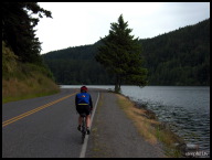
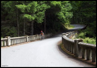
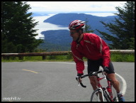
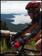
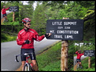
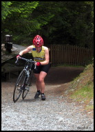
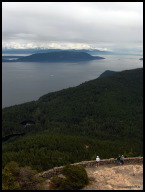
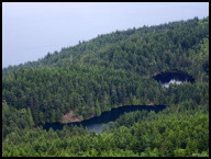
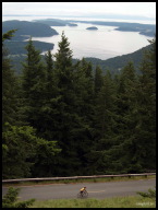
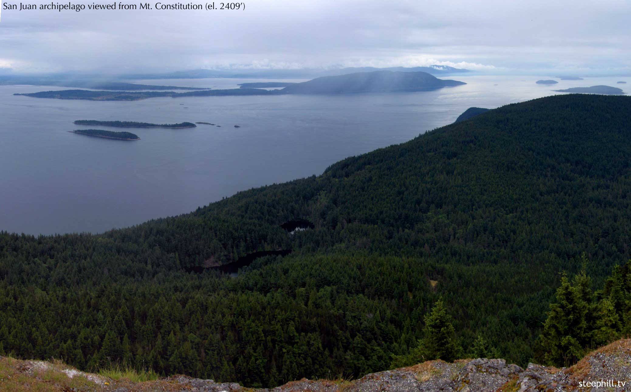
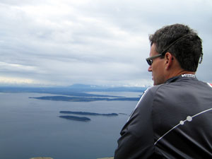 We found the best island for our type of cycling was Orcas Island where the terrain featured more hilly, shoreline roads. There was even a very challenging 6 mile switchback climb through Moran State Park going from sea-level all the way to the top of Mt. Constitution (el. 2,409') with about 1550 ft of climbing in a difficult 3 mile stretch to Little Summit. Crunching the numbers, that tough 3 mile section works out to an average grade of 10%... guaranteed to test anyone's constitution! Mt. Constitution is the highest point in the Islands and apparently offers the best view in the archipelago. A stone observation tower allows visitors to climb high enough above the summit for a 360-degree panoramic view. On a clear day you can, as they say, see forever: Vancouver, Canada to the north, the Cascade Range and Bellingham to the east, the rest of the San Juans and the Gulf Islands, Anacortes and the Olympic Range to the south. Our view wasn't quite that clear (see top & right photos) but the view looking down on the thick evergreen covered archipelago was dramatic enough. Our 50+ mile spider ride of Orcas Island was superb and it exceeded our expectations.
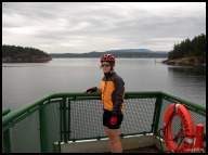
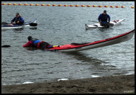
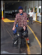
 Overall, the San Juans are very good place for intermediate cyclists and offer the potential of an excellent multi-sport vacation for everyone. The sea-kayaking, in particular, looked very appealing since the Islands are within paddling distance of one another. But, if you were an experienced cyclist who had read the rave reviews before going, I think you'd be somewhat let down. There is a lot to like about the San Juans but some cycle travel writers have gotten carried away and oversold this place. Nonetheless, we enjoyed our time, especially since we hadn't read any reviews beforehand! Island hoping by ferry and bike was a lot of fun and Mt. Constitution provided a killer climb (and view). The San Juan ferry system encourages bike transportation by making inter-island ferries free to cyclists. Next time, we'll check out the smaller islands such as quiet, flat Lopez and Shaw Islands and the local secret, tiny, Guemes Island. Our only regret, during our stay, was not taking a picture of a scientist conducting brain surgery on a sea slug, Tritonia, when we toured the labs. Do you know that a sea slug contains only 5,000 brain cells? Still... enough to be President. -- Steve Hill July 23/05